By Beth Treffeisen
In order to accommodate the continued growth in both jobs and population, the citywide draft plan under Imagine Boston 2030 has pointed out potential places of growth on the outer edges of the city.
“We have to identify different places in the city where Boston can grow and expand,” said Mayor Martin Walsh. “There’s only a certain amount of square miles in the city and there are certain areas where you can’t grow. We’re looking at where we can continue to grow in the future.”
On Thursday, November 17, Mayor Walsh released the Imagine Boston 2030 draft plan that outlines the key components of what the City needs to strive for in order to make the city thrive in 2030 and beyond to 2050.
The plan was crowd sourced from over 12,000 residents who offered feedback as part of an extensive community engagement effort that ran across the city. It will continue to receive feedback up until the final release next year.
This will be the first citywide plan to be created in 50 years. The plan will be setting a strategic vision for growth and enhancement while identifying key initiatives to support this vision.
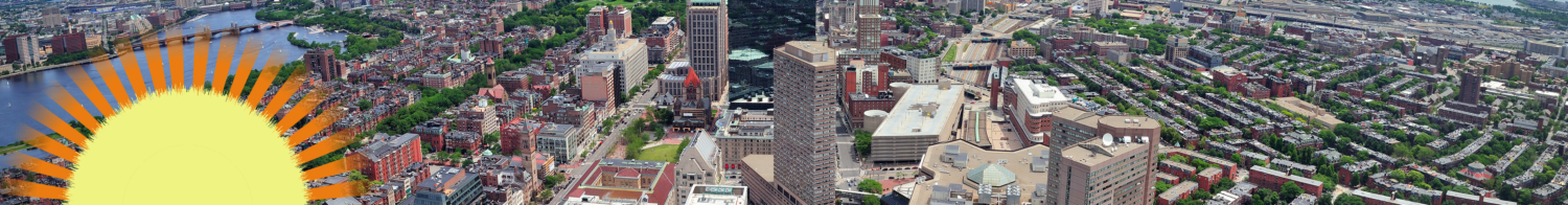
Boston is projected to reach a population of 724,000 by 2030, which is up from the population of 656,000 in 2014.
Significant job growth is expected to occur alongside the population growth. By 2030, Boston is expected to be home to 829,000 workers, an increase of 15 percent from 719,000 in 2014.
“In order to capture full benefits of that growth we want to think about how we guide that growth,” said Rebekah Emanuel the director of Imagine Boston 2030. “From a pure land perspective we know that we got a limited land budget as to where to guide that.”
The plan identifies three types of places of growth and enhancement including existing neighborhoods, commercial cores, and neighborhood edges that have the capacity to accommodate Boston’s projected growth in population and housing needs.
Neighborhood edges are made up of commercial cores or are clearly defined by transportation and other infrastructure or large open spaces. But, other edges are less clear, formed by collections of vacant or low-density commercial lots clustered at the border of a stable residential neighborhood.
A new expanded neighborhood plan will transform those areas by adding mix-use residential housing.
By doing so the plan hopes it will encourage job growth in transit-accessible areas at the boundaries of existing neighborhoods and will reduce the housing-price pressure seen today in the City.
“Interesting many of the expanded areas… are also in close proximity to transit. So while Suffolk Downs or Beacon fields feel like they are far away they actually are well positioned and in close proximity to our existing infrastructure,” said Sarah Myerson the director of planning of the Boston Planning and Development Agency.
She continued, “So everywhere if we build out that infrastructure and continue to invest in it you’ll have better connections all throughout the city.”
Funding for creating these connections through transportation will continue to come from federal, state, city and possibly private funds.
Specific places for improvement include Suffolk Downs in East Boston, where it can potentially transition from it’s current use as a horse race track and various industrial uses to a climate-ready, mixed-use residential area along with other signature open spaces.
Sullivan Square in Charlestown, which contains several government-owned parcels that currently holds low-density industrial uses and parking is also included as a potential spot to create more walkable jobs and housing.
“The question becomes where else do we go?” said Emanuel pointing to a map of potential growth areas. “You have these sort of edge areas and here you see sort of a sprinkling of bread crumbs, smaller areas of edge areas and larger clusters of growth. These are areas where you can imagine transformational change.”
Changes have already begun in some of these expanded neighborhoods including recent residential development around Broadway Station, Jackson Square, and the Harrison-Albany Corridor.
Another example is Boylston Street in the Fenway that was once an auto-oriented edge between active neighborhoods in the commercial core. It is now home to many new high rises and a vibrant atmosphere filled with residents, places to work, restaurants and retail.
Elsewhere the plan outlined a need to make the city better prepared for climate change and the need to keep the waterfront an active economic hub. It also showed the potential of linking the Emerald Necklace by connecting the final section from Franklin Park to the waterfront.
“This is a living document — it’s not complete,” said Mayor Walsh. “We’re going to be talking about it and taking concerns and suggestions from residents.”
Imagine Boston Week will run to December 5, where residents will become engaged to give specific feedback on the draft plan.
Continued feedback is still being collected online. To submit your own comments visit www.imagine.boston.gov.